RealTimeSeismic
One of the industrial arms of PIXIL will be RealTimeSeismic, whose main field of action is the processing of seismic data related to geothermal energy and the development of computer applications related to geosciences.
Presentation of the company:
RealtimeSeismic (RTS) is a french company founded in 2016, with registered office at 2 avenue Pierre Angot, 64000 Pau, France.
With about 10 specialized geophysicists, commercial and proprietary software, RealTimeSeismic provide services and products for various geoscience applications, like underground exploration, seismology, near-surface engineering and environmental geophysics.
Specialized in complex land data, RTS can deploy real-time processing solutions and fast processing and imaging for the acquisition optimization. With their partners, RTS cover the full geoscience integrated chain, from the survey design to the field operations, to the interpretation.
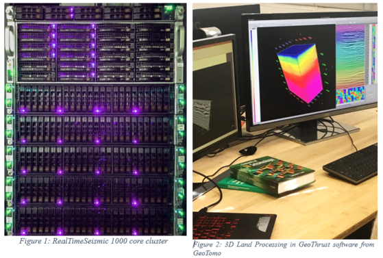
RTS use modern hardware (Figure 1), interactive and efficient proprietary software tools, combined with industry reference commercial processing platforms, such as GeoThrust from GeoTomo (Figure 2) is essentially used for Land processing.
RTS is therefore able to shake up the current industrial offer, providing state-of-the-art seismic services but with shorter deadlines and competitive prices.
RTS is specialised in high-end geophysical processing, in workflow acceleration and decision optimisation. We have completed more than 50 projects in four years in diverse geographical areas and diverse industrial sectors, including geothermal projects. We have an extensive experience dealing with challenging 2D/3D data sets such as land seismic recorded in mountainous or foot-hills.
RTS contribution to the PIXIL project:
- RTS is the only private company of the PIXIL project. Over the past four years, we have participated and accompanied the development of the geothermal industry in France through the provision of various types of geophysical services, in a commercial environment. These services covered land acquisition support, seismic data processing and microseismic monitoring.
- We bring this industrial view, expertise and experience to the PIXIL project, by supporting and advising on the work that INRIA accomplishes.
- The topic that we have selected commonly with INRIA is justified by our internal strong expertise (seismic processing of challenging seismic data and surface wave analysis), which overlaps with INRIA topics of research (Full Wave Inversion in the frequency domain).
- The conjunction of RTS expertise (Surface Wave Analysis, Seismic Processing) and INRIA theme of Research (FWI) led naturally to work together on the forward modeling and the inversion of surface waves using full waveform signals.